Sumy Airport
Sumy Airport Аеропорт "Суми" | |||||||||||
|---|---|---|---|---|---|---|---|---|---|---|---|
| Summary | |||||||||||
| Airport type | Public | ||||||||||
| Operator | Civil Government | ||||||||||
| Serves | Sumy | ||||||||||
| Location | Sumy, Sumy Oblast, Ukraine | ||||||||||
| Elevation AMSL | 594 ft / 181 m | ||||||||||
| Coordinates | 50°51′30″N 34°45′45″E / 50.85833°N 34.76250°E | ||||||||||
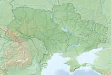
| Map | |||||||||||
| Runways | |||||||||||
| |||||||||||
 | |||||||||||
Sumy Airport (IATA: UMY, ICAO: UKHS) is a state international airport located in Sumy, Ukraine. It has become international since 8 December 2006. The airport is capable of accepting such aircraft as the Tu-134 (with limitations), An-24, Yak-40, and aircraft of lower classes round-the-clock. The capacity of the airport terminal is 100 passengers per hour. As of August 2008, there are no flights scheduled from the capital Kyiv[citation needed]. The airport hosts car shows.
See also
External links


